



On this page
- The walks at a glance
- Aleea de sub Tâmpa: the flat promenade under the mountain
- Tâmpa on the Serpentine Road
- Tâmpa on the Gabony steps
- Walls and towers: Strada După Ziduri, the Black Tower and the White Tower
- Dealul Cetății: up to the Citadel (Cetățuia)
- Pietrele lui Solomon (Solomon’s Rocks)
- The old road to Poiana Brașov (Drumul Vechi al Poienii)
- Flat walks in the city’s parks
- Tips
- FAQ
- Sources
The easiest walk in Brașov is Aleea de sub Tâmpa: about 1 km, flat, paved and lit. The classic hike is up Tâmpa on the Serpentine Road: 3 km, 1 h 15 – 1 h 30, and 30 lei for the cable car down. For a half-day, take bus 50 to Pietrele lui Solomon and walk to Poiana Brașov.
Advertisement
The walks at a glance
Distances and times for the marked trails are from the Munții Noștri trail register; the city walks are measured on the map.
| Walk | Start | Distance | Time | Climb | Waymark | Getting back |
|---|---|---|---|---|---|---|
| Aleea de sub Tâmpa | Weavers’ Bastion, Str. George Coșbuc | about 1 km one way | 15–20 min | flat | none (paved) | same way, or into the Old Town |
| Tâmpa: Serpentine Road | Drapers’ Bastion, Aleea Tiberiu Brediceanu | 3 km to the summit | 1 h 15 – 1 h 30 up | 380 m | red triangle | same path or the cable car |
| Tâmpa: Gabony steps | Drapers’ Bastion | about 2 km to the summit (estimate) | 1 h – 1 h 30 up (estimate) | about 400 m, steep | yellow triangle | Serpentine Road down |
| Walls and towers | Catherine’s Gate | about 1 km | 20–30 min | two short flights of steps | none | Piața Sfatului |
| Dealul Cetății (Citadel Hill) | Bulevardul Eroilor | about 1 km from Piața Sfatului | 15–20 min each way | short, with steps | none | same way |
| Pietrele lui Solomon | Bus 50 terminus “Solomon” | short paths | 30 min – 1 h | small | various | bus 50 |
| Old road to Poiana Brașov | Pietrele lui Solomon | 4.2 km | 1 h 30 – 1 h 45 | 325 m | red stripe | bus 20 from Poiana Brașov |
Reading the waymarks: Romanian mountain trails are marked with a coloured symbol (stripe, triangle, cross or dot) painted on a white background on trees and rocks. Follow both the colour and the shape.
Bears: brown bears live in the forests around Brașov, including the Tâmpa reserve, and are sometimes seen at the edge of town. Stay on the marked paths, walk in daylight, keep food packed away, and never approach or feed a bear.
Aleea de sub Tâmpa: the flat promenade under the mountain
Start: the Weavers’ Bastion at Strada George Coșbuc 9, ten minutes’ walk south of Piața Sfatului. End: the Drapers’ Bastion (Bastionul Postăvarilor). About 1 km, 15–20 minutes one way, flat, paved and lit.
Aleea Tiberiu Brediceanu, known to everyone as Aleea de sub Tâmpa, runs between the forested foot of Tâmpa and the outside of the city walls. You pass the Weavers’ Bastion, the lower station of the Tâmpa cable car and stretches of wall and bastion on the way to the Drapers’ Bastion, where the trails up Tâmpa begin.
It suits pushchairs, runners and anyone who wants a view of the walls without a climb. Walk back the same way, or go through the Old Town: Piața Sfatului is about ten minutes from either end.
The Weavers’ Bastion at the start houses the 1896 model of the medieval city. It is open Tuesday–Sunday 10:00–18:00 and costs 10 lei; see our museums guide.

Tâmpa on the Serpentine Road
Start: the Drapers’ Bastion in Parcul Tiberiu Brediceanu, at the north-eastern end of Aleea de sub Tâmpa, about ten minutes’ walk from Piața Sfatului. 3 km, 380 m of climbing, 1 h 15 – 1 h 30 up. Waymark: red triangle. Difficulty: easy to moderate.
The Serpentine Road (Drumul Serpentinelor) is the shortest walking route to the top of Tâmpa, which is 955–960 m high and about 400 m above the Old Town. It is a forest path cut in 1837 that zigzags up the slope in long hairpins, so the gradient stays manageable, and ends with a short climb from a saddle north-east of the summit.
At the top are viewpoints over the whole city and the BRAȘOV letters on the slope below. The medieval Brassovia citadel stood between the peak and the crest until the townspeople demolished it after 1421 and reused its stone in the walls below.
Getting back down:
- On foot: the same path; the descent is quicker but hard on the knees.
- By cable car: the upper station is a short walk from the viewpoint. The operator lists one-way tickets at 30 lei (children 6–12: 20 lei) and returns at 45 lei, with hours Monday 12:30–22:00, Tuesday–Thursday and Sunday 10:30–22:00, Friday–Saturday 10:30–22:30 (telecabina-tampa.ro, checked 10 October 2026). The line is 573 m long with a 320 m height difference. The lower station is on Aleea de sub Tâmpa, so you end up back at the start.
Tâmpa on the Gabony steps
Start: the Drapers’ Bastion, as above; the steps begin at a stone bench known as Banca lui Alesius, a short climb above the start. Waymark: yellow triangle. Difficulty: moderate; steep.
The steeper way up follows the concrete steps built by Gabony in 1930–1931, with sections of more than 30 % gradient. The yellow-triangle route continues over the summit and down to Valea Cetății, a total of 4.7 km with 430 m of climbing and 310 m of descent, which takes 2 h – 2 h 45.
A good loop is up the steps and down the Serpentine Road, about 5 km in total by our estimate. The steps are slippery when wet or icy, and the waymarks are sparse on the far side of the summit towards Valea Cetății. Details are in the Munții Noștri route description.
Walls and towers: Strada După Ziduri, the Black Tower and the White Tower
Start: Catherine’s Gate. End: Piața Sfatului. About 1 km, 20–30 minutes, with two short, steep flights of steps.
Strada După Ziduri (“Behind the Walls”) is a lit, paved lane along the outside of the western wall. From Catherine’s Gate, follow it north along the wall: the Black Tower stands on a rock above the lane, and at the Graft Bastion a long flight of steps leads up to the White Tower, with the best view of the Old Town from this side.
From the White Tower, come back down the steps and walk into Piața Sfatului past the Graft. The history of both towers is in our walking route past Brașov’s five landmark buildings.


Advertisement
Dealul Cetății: up to the Citadel (Cetățuia)
Start: Bulevardul Eroilor, by the Art and Ethnography museums. About 1 km from Piața Sfatului, 15–20 minutes each way, a short climb on paths and steps.
The small hill north of the Old Town is topped by the Cetățuia, the citadel on Straja hill. Paths and steps lead up through the trees from the Bulevardul Eroilor side and from Strada Dealul Cetății to the citadel walls, with the Old Town and Tâmpa to the south. It is the quickest climb in town, good for a short walk before or after the museums on Bulevardul Eroilor.
Pietrele lui Solomon (Solomon’s Rocks)
Start: the last stop of bus 50, “Solomon”, at the far end of the Șchei district. Short paths, from 30 minutes to an hour.
At the top of Șchei the town ends at a cluster of limestone rocks and a stream at the foot of the Postăvarul massif. It is a popular local spot for a short walk in the forest, and the starting point of several marked trails, including the old road to Poiana Brașov, described below, and a short red-triangle path through Vâlcelul Dracului to Stejerișul Mare, which is 1.9 km and about an hour.
Getting there: bus 50 runs from Camera de Comerț via Piața Unirii, by the First Romanian School, to Solomon. From the Solomon terminus there are departures every 9–18 minutes on weekdays during the day and about every 13–14 minutes at weekends from 09:00. The last bus back leaves at 23:23 on weekdays and 22:40 at weekends, according to the RAT Brașov timetable, valid from 7 September 2026.
A single ticket costs 5 lei and is valid for 90 minutes. A day pass costs 20 lei, according to RAT Brașov fares.
The old road to Poiana Brașov (Drumul Vechi al Poienii)
Start: the Pietrele lui Solomon bus terminus, at about 700 m altitude. End: Poiana Brașov, near Hotel Ruia, at about 1,030 m. 4.2 km, 325 m of climbing, 1 h 30 – 1 h 45. Waymark: red stripe. Difficulty: easy.
This was the main road up to Poiana Brașov until 1966 and is now closed to traffic. From the bus terminus, take the road on the right that is closed to vehicles: it is paved, fitted with wooden railings, and climbs gently through the forest to Hotel Căprioara at Poiana Mică.
From there the red-stripe path continues through spruce and beech forest on the left of the main road and comes out in the upper part of Poiana Brașov near Hotel Ruia. Route details are from the Munții Noștri description.
Getting back: walk into the resort and take bus 20 down to Livada Poștei, on the edge of the Old Town. It is an urban line, so the same 5-lei single ticket applies. Or walk back down the same way.
Flat walks in the city’s parks
If you want greenery without a climb, Brașov has three large parks within reach of the centre:
- Parcul Central (Nicolae Titulescu), by Bulevardul Eroilor, is five to ten minutes’ walk from Piața Sfatului and has flowerbeds and shaded paths.
- Parcul Tractorul, in the newer Tractorul district north-east of the centre, has long, flat paths through young trees.
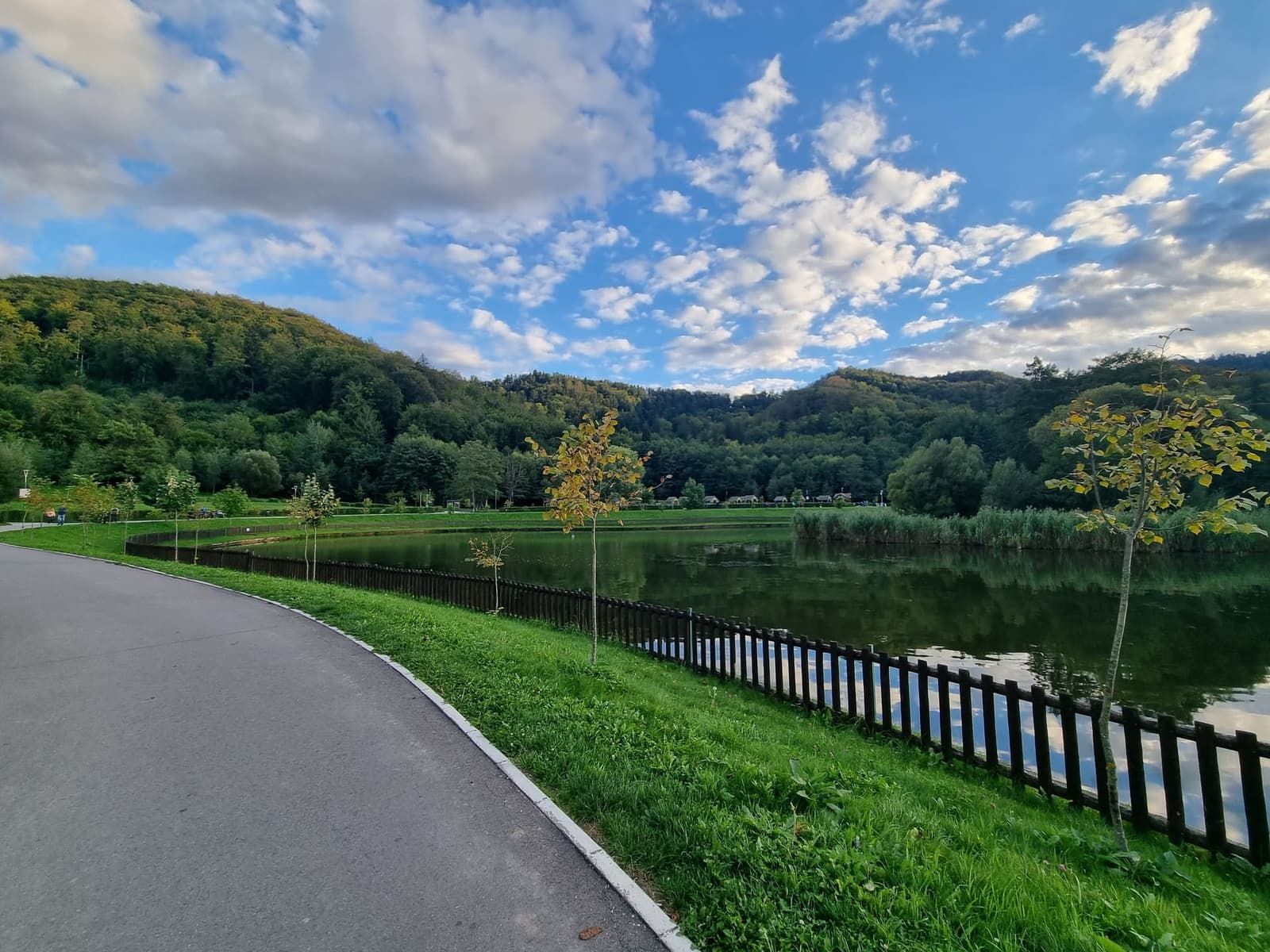
- Lacul Noua, in the Noua district on the south-eastern edge of the city, has a paved path along the lake at the foot of the forest. Buses 17 (from Livada Poștei) and 35 (from the railway station) go to Noua.


Tips
- Shoes: trainers are fine for the promenade, the towers and the old road; for the Tâmpa paths and the Gabony steps, wear shoes with grip.
- Season: in winter the Tâmpa paths and the Gabony steps can be icy; the paved promenade and the old road are the safer choices.
- Water and light: take water up Tâmpa, and start early enough to be down before dark; the forest paths are not lit.
- Combine: the promenade and the Tâmpa trails start next to the Weavers’ Bastion and the Black Church is ten minutes away (see our Black Church guide). Pietrele lui Solomon is on the same bus line as the First Romanian School.
For more ideas in and around the city, see our guide to things to do in Brașov, and check what to wear in Brașov today before you set off.
FAQ
How long does it take to walk up Tâmpa?
1 h 15 – 1 h 30 on the Serpentine Road from the Drapers’ Bastion: 3 km, 380 m up, marked with a red triangle. The Gabony steps are shorter but steeper.
Can you walk up Tâmpa and take the cable car down?
Yes. The operator lists one-way tickets at 30 lei for adults and 20 lei for children aged 6–12. The lower station is on Aleea de sub Tâmpa, close to where the trails start.
Is there an easy walk in Brașov without climbing?
Aleea de sub Tâmpa: about 1 km, flat, paved and lit, along the city walls. The city parks, Parcul Central, Parcul Tractorul and Lacul Noua, are also flat.
How do you get to Pietrele lui Solomon?
Bus 50 to its last stop, “Solomon”; it passes Piața Unirii. A single ticket costs 5 lei.
Can you walk from Brașov to Poiana Brașov?
Yes, on the old road from Pietrele lui Solomon: 4.2 km and 325 m of climbing, about 1 h 45, marked with a red stripe. Take bus 20 back down.
Are there bears on Tâmpa?
Brown bears live in the forests around Brașov, including the Tâmpa reserve. Stay on marked trails, walk in daylight and never feed or approach them.
Sources
- Trail lengths, times, climbs and waymarks (Serpentine Road 05MN35, Gabony steps 05MN34, old road to Poiana 05MN39): Munții Noștri; other trail codes from OpenStreetMap hiking relations
- Tâmpa height, history and the Brassovia citadel: Wikipedia, Tâmpa (Brașov)
- Cable car prices, hours and line data: telecabina-tampa.ro, checked 10 October 2026
- Bus 50 timetable and route: RAT Brașov; fares: RAT Brașov tariffs, checked 10 October 2026
- Weavers’ Bastion hours and price: brasovistorie.ro, checked 10 October 2026
Advertisement
What changed
- Rewritten as a guide to walks and easy hikes, with start points, distances, times, climbs, waymarks and the way back for each route.


